Our service areas
Throughout British Columbia, we’re where we need to be.
North Peace (Main yard — fort st. john)
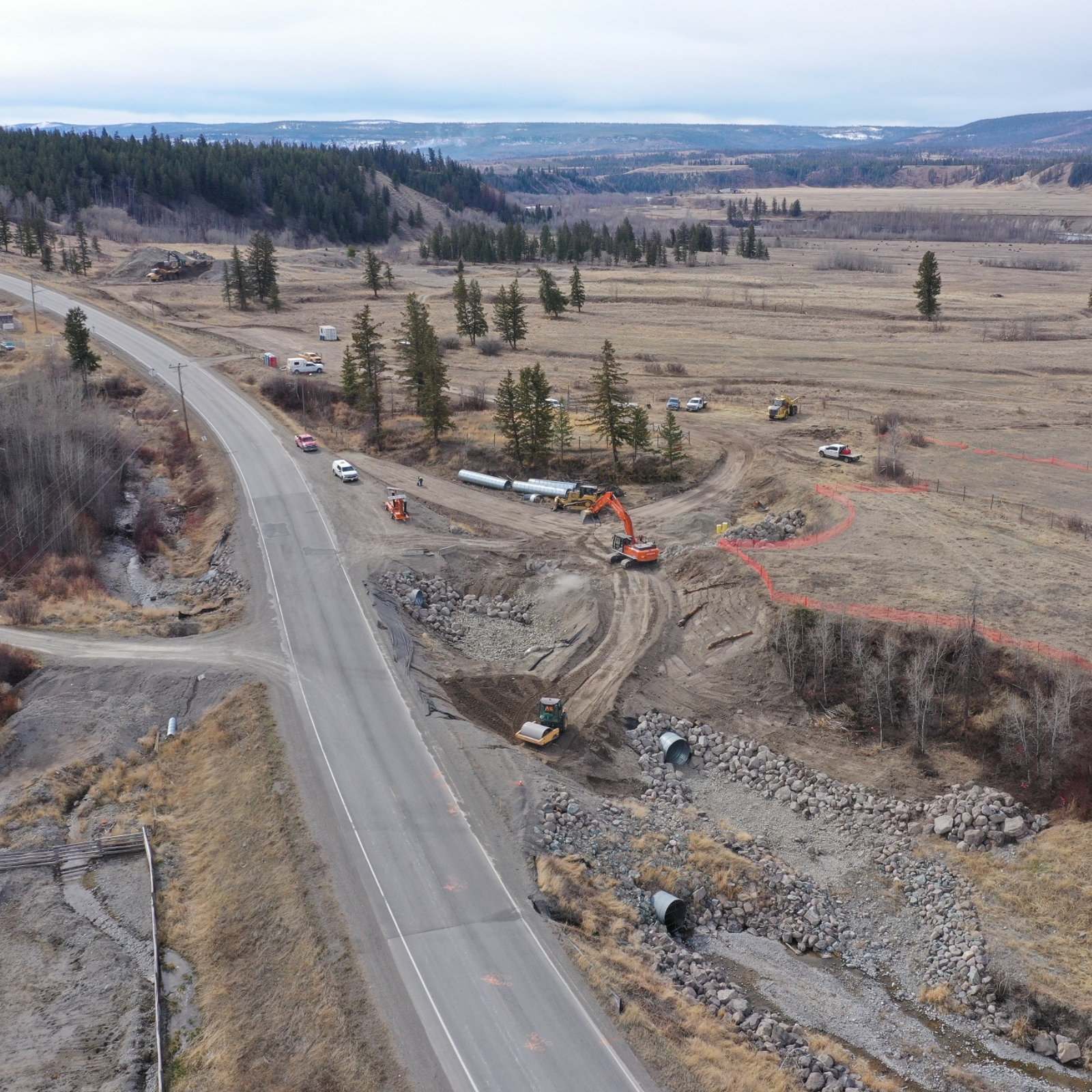
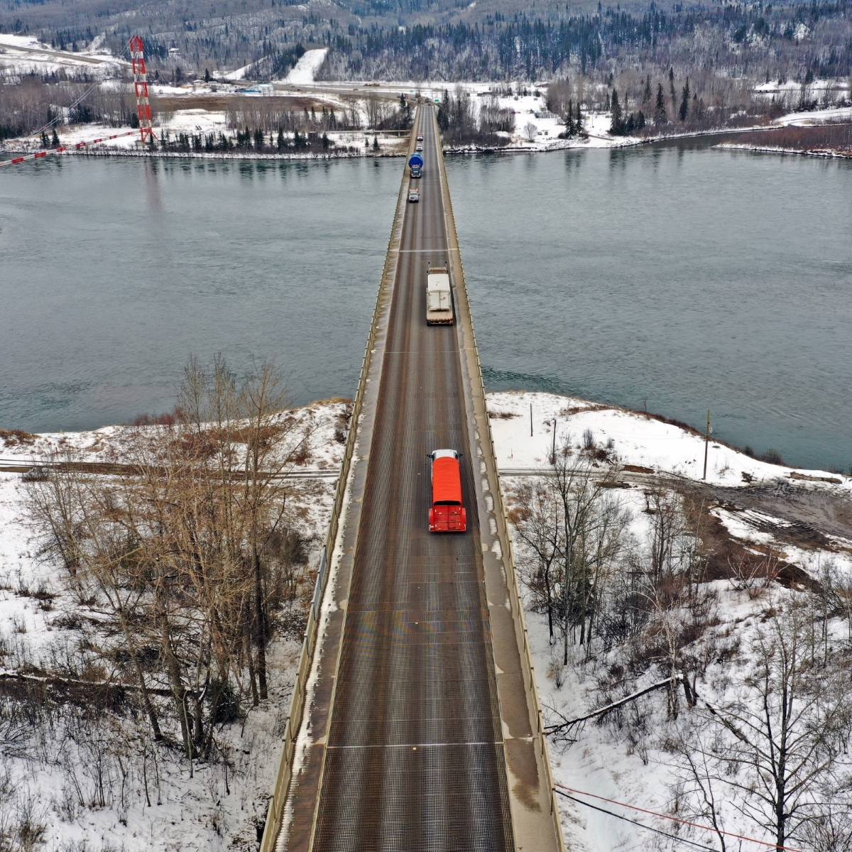
Service Area 22 (SA 22) is in the northeastern area of B.C., north of Dawson Creek and encompassing Alaska Highway 97N. The boundary of SA 22 to the south is formed by the Peace River. The area borders onto Alberta in the east and the Yukon and Northwest Territories in the north.
The area includes the municipalities of Taylor, Fort St. John and Hudson Hope as well as rural communities within the Peace River Regional District. Fort Nelson and the Northern Rockies Regional Municipality is situated in the northern portion of the area. B.C.’s northeast is the provincial hub for the oil and gas industry, which is the predominant industry in the area.
SA 22 encompasses approximately 4,900 lane-kilometres of maintained and unmaintained highways with 77 bridges. A unique aspect of SA 22 is that the majority of Highway 97 (north of Fort St. John) is maintained by a separate maintenance provider contracted by the federal government.
Bulkley-nass (main yard — Smithers)
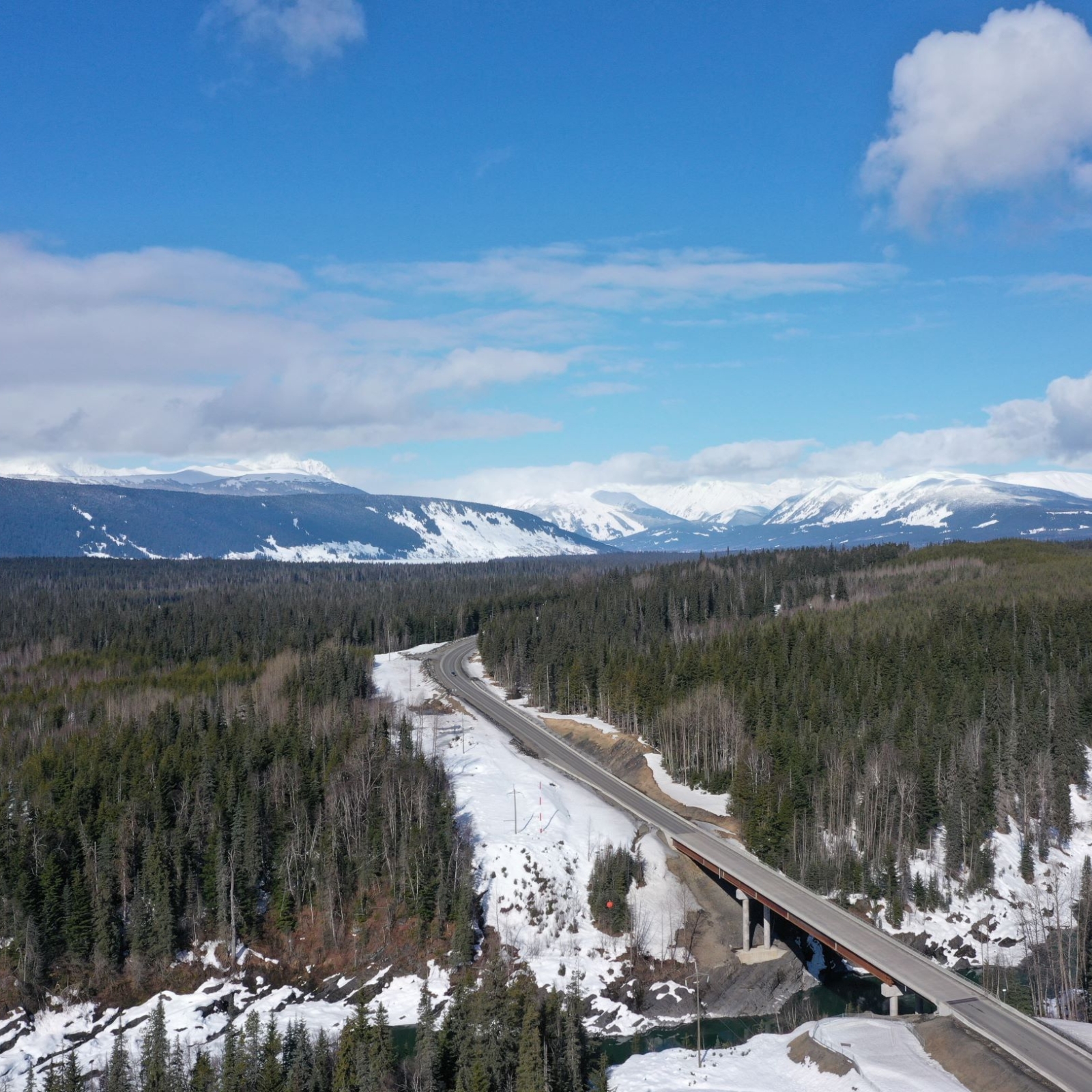
Bulkley-Nass (SA 25) is in the north-central area of British Columbia, west of Prince George along the TransCanada/Yellowhead Highway 16. The boundary of SA 25 adjoins Service Area 24 to the east on Highway 16, adjoins Service Area 26 to the west 51 km east of Terrace, and adjoins Service Area 28 to the north at Deltaic Creek, 221 km north of Kitwanga on Hwy 37.
SA 25 has approximately 2,476 lane-kilometres of maintained roads, which includes approximately 980 lane-kilometres of numbered highways, seven rest areas, approximately 94 bridges, 34 bridge-size culverts, four retaining walls and one tunnel.
SA 25 encompasses the municipalities of Telkwa, Smithers, New Hazelton, Hazelton and Stewart. Many smaller rural and non-incorporated communities and reserves are accessed via Highways 16 and 37 throughout the service area, within the Regional District of Bulkley-Nechako and the Regional District of Kitimat-Stikine.
South Cariboo (main yard — 100 mile house)
South Cariboo (SA 16) is in the south-central area of B.C. along TransCanada Highway 1 from Spences Bridge to Cache Creek, west to Lillooet on Highway 99 and Highway 12 and north along Highway 97 to the north end of Lac La Hache. It includes Road 40 to Goldbridge and the Highline Road to D’Arcy.
The district extends to the Big Bar Ferry, which is about 100 kilometres west of Clinton. SA 16 encompasses the municipalities of 100 Mile House, Clinton, Cache Creek, Ashcroft and Lillooet and rural communities in the Cariboo Regional District, Thompson-Nicola Regional District and the Squamish Lillooet District.
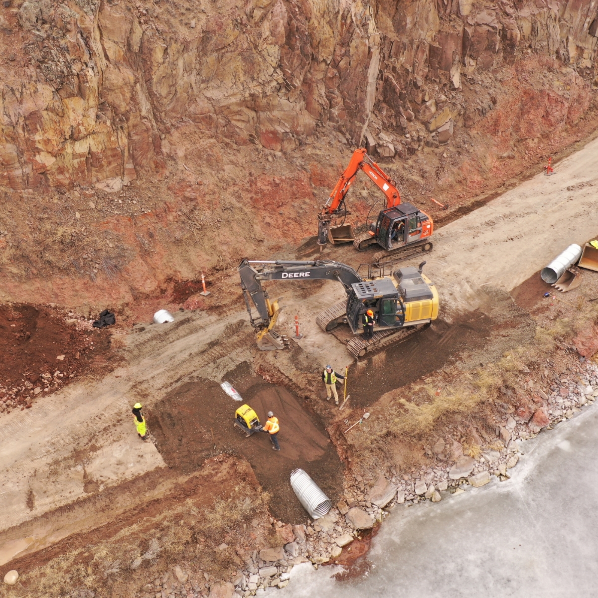
SA 16 has approximately 5,873 lane-kilometres of maintained roads, which includes approximately 1,085 lane-kilometres of numbered highways, five rest areas and approximately 180 bridges, marine structures, retaining walls, tunnels and a retaining wall. There are numerous avalanche control areas along Highway 99 and Road 40 in the Lillooet area. The Lillooet area is known for many rockfall and debris flow sites.
100 Mile House serves as a hub for the local logging, saw-milling, ranch operations-oriented strand board plant and tourist industries. It also serves as the main commercial centre for the surrounding area. Clinton and Chasm also serves the local logging, ranching saw-milling, mining and tourist industries. The Big Bar Reaction Ferry is located about 100 km west of Clinton.
Cache Creek and Ashcroft are communities with railway terminals and connections to Highland Valley Mine and IG Machinery mine, industries include ranching and tourism.
Lillooet is the hub for tourism, logging, mills and major B.C. Hydro Dam operations. Communities near Lillooet include Shalalth, Seton Portage, Braelorne, Goldbridge and Gun Lake, Bridge River First Nation community, Xaxli’p (Fountain) community and the Pavilion Community.
central cariboo (main yard — williams lake)
Central Cariboo (SA 17) is in the central interior area of B.C. Williams Lake serves as the hub for SA 17 at the junction of Cariboo Highway 97 and Chilcotin-Bella Coola Highway 20. The boundary of SA 17 adjoins SA 16 to the south and SA 18 to the north, both via Highway 97.
SA 17 encompasses the City of Williams Lake and rural communities within the Cariboo Regional District and the Central Coast Regional District. SA 17 has approximately 4,827 lane-kilometres of maintained roads, which includes approximately 1,153 lane-kilometres of numbered highways), seven rest areas, approximately 152 bridges, 13 retaining walls, and seven bridge-size tunnels).
Williams Lake serves as the hub for local logging, saw-milling, mining, ranching and tourist industries. It also serves as the main commercial centre for the surrounding areas including Horsefly, Likely, Alexis Creek, Tatla Lake, Nimpo Lake, Anahim Lake and the Bella Coola Valley. It is also the location of the head offices of the Cariboo Regional District.
SA 17 provides access to several spectacular bodies of water, including:
- QUESNEL LAKE
The deepest fjord lake in B.C., it is 120 kilometres long, reaching maximum depths of 610 metres, with a total of 600 kilometres of shoreline to explore. The lake is home to a quarter of B.C.’s sockeye salmon fishery. - CHILKO LAKE
Located about 90 kilometres southwest of Williams Lake in the Nemiah Valley, the lake is 80 kilometres long and is entirely encompassed in the Ts’yl-os park, administered by the Xeni Gwet’in First Nation. - NIMPO LAKE
Located 299 kilometres west of Williams Lake on Highway 20. Nimpo Lake is known as the float-plane capital of B.C. and provides a gateway to the expansive Chilcotin wilderness via float plane.